
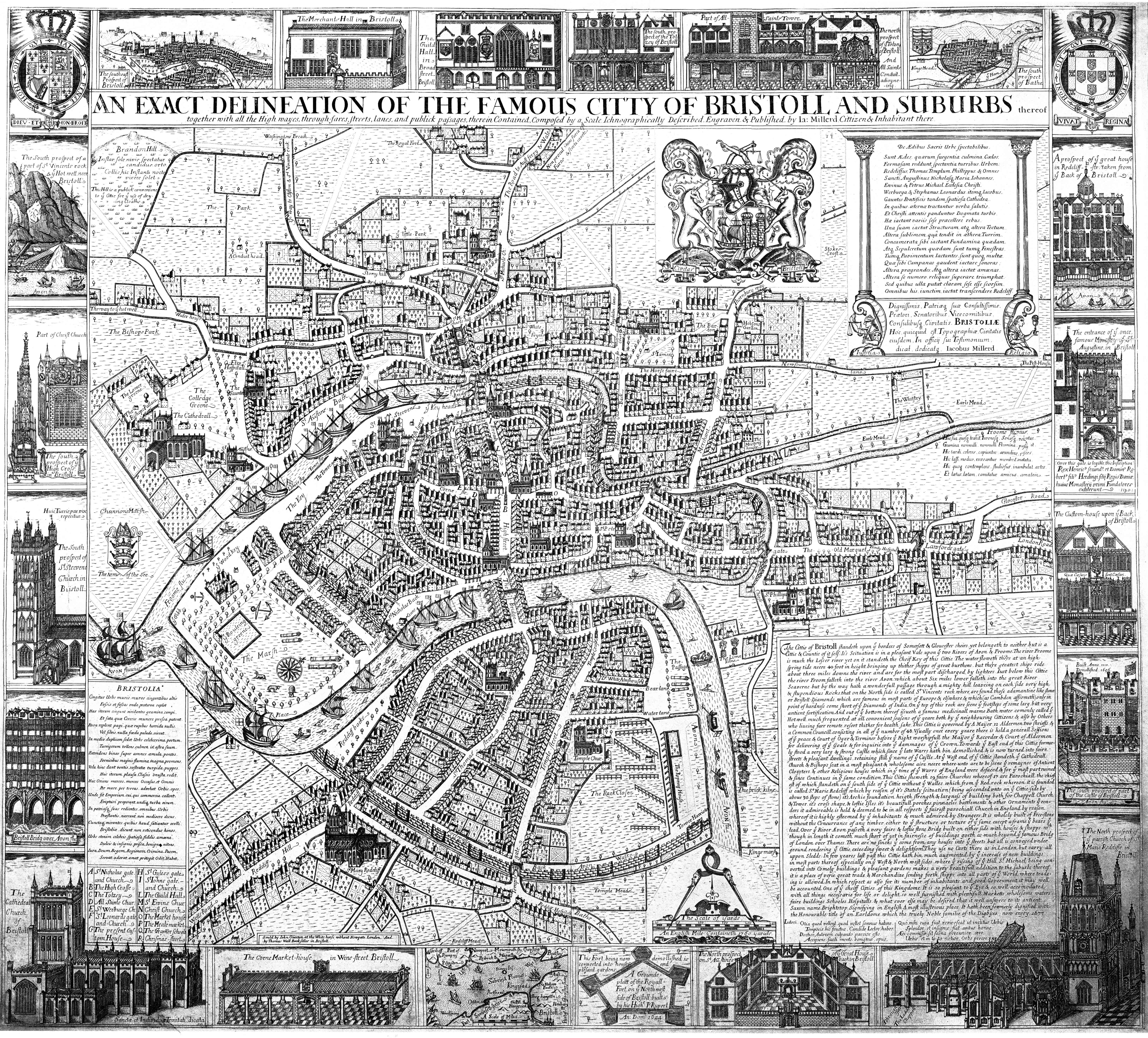
Frome Bridge was a fortified 13th-century bridge in Bristol. The defences were pulled down in 1694, and no traces of the bridge survive today. The bridge controlled the northern route into the city across the River Frome, and was a strategic point in Bristol’s defences during the English Civil War of the 1640s.
History
13th-16th centuries
Frome Bridge was probably constructed in the 13th century. The north side of Bristol was redeveloped in the middle of the century, as parts of the River Frome were recut, establishing the New Channel to create docks. A new stretch of town walls were built to the east of the docks. The bridge linked Bristol with the north. It was probably built from timber, and had gatehouses at either end, the northern one being known as Frome Gate. The gatehouses were probably built mostly in stone.
In 1534, the space above Frome Gate was occupied by the new Bristol Grammar School – another school had been established over New Gate in the 1420s.
17th century
In 1642, civil war broke in England out between the supporters of King Charles and Parliament. Thomas Essex quickly moved to secure Bristol for Parliament. The city’s defenses were mobilised by the Royalists, and Frome Gate – where the city authorities believed Essex would probably attack – was armed with two cannon. There was then a pro-Parliamentary protest in the city, with demands to let Essex in. In an effort to avoid bloodshed, the Royalists who controlled Frome Gate were allowed to keep it closed, but Parliamentary supporters opened New Gate, and Essex quickly occupied the city.The Parliamentary governor, Nathaniel Fiennes,
In March 1643, Frome Gate was the centre of a Royalist conspiracy to retake control of the city. A plan was formed to seize the bridge and let nearby Royalist forces into Bristol. The Parliamentary governor, Nathaniel Fiennes, was informed of the plot, and moved to make arrests. 77 Royalist supporters were arrested, along with 20 muskets and large amounts of money.

In July 1643 a Royalist army under the command of Sir Ralph Hopton and Prince Rupert assembled to take the city. Fiennes refused to surrender and on 26 July, the Royalists attacked. Parts of the army began the assault early and the attack was chaotic, but by mid-morning Royalist troops reached Frome Bridge, amid heavy house-to-house fighting.
A group of women, led by Dorothy Hazard and Joan Batten, appear to have worked with military engineers to build a tall barricade from wool sacks and earth, blocking Frome Gate. Nonetheless, Parliamentary morale faltered, and Fiennes ordered his forces to the north of the city to retreat, falling back across Frome Bridge. After a brief sally, Fiennes opened up negotiations in the early afternoon and surrendered Bristol to the Royalists that evening.
The civil war steadily turned against the Royalists. When Parliamentary forces took Bristol for the second time in 1645, however, the assault came from further east and west of the main northern defences, and Frome Bridge played little part in the fighting.
By the end of the century, Frome Bridge’s gatehouses were no longer needed militarily, and probably disrupted the flow of traffic in and out of the growing city of Bristol: they were pulled down in 1694. The eventual fate of the medieval bridge is unclear – the stretch of the Frome on which it stood was culverted over in 1893.
Bibliography
- Baker, Nigel, Jonathan Brett and Robert Jones. (2018) Bristol: A Worshipful Town and Famous City: An Archaeological Assessment. Oxbow Books: Oxford, UK.
- Lynch, John. (2009) Bristol and the Civil War: For King and Parliament. The History Press: Stroud, UK.
- Orme, Nicholas. (2004) “Education in Medieval Bristol and Gloucestershire”, Transactions of the Bristol & Gloucestershire Archaeological Society Volume 122 pp.9–27.
- Robinson, Richard. (1868) The Sieges of Bristol During the Civil War. Leech and Taylor: Bristol, UK
Attribution
The text of this page is licensed under under CC BY-NC 2.0.
Photographs on this page include those drawn from the Wikimedia website, as of 11 May 2020, and attributed and licensed as follows: “1673 Milford Map detail” (Public Domain).